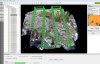
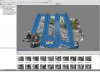
I have been testing both Pix4D and Photoscan software with a few data sets I have taken around the Lake Tahoe area, I wrote a small blog post about my experiences along with some of my settings used during flight.
Interesting, thanks, i have P3P with which i am experimenting. I have done a trial with Agisoft Pro - excellent software. But it seems that large sets of data cannot be handled always. Also with Pix4D. The ortophoto from Pix4D is slightly better around building structures it seems. Downside of Pix4D is price and that internet connection is always a requirement. But both are excellent software. Cheers