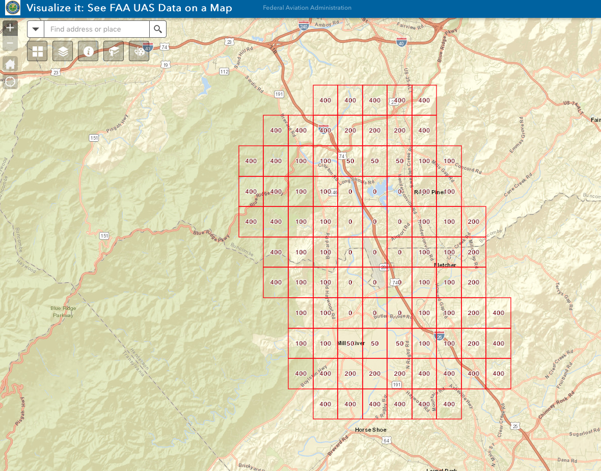
Those are the limits for approval when you request an authorization and are there to help you get approval quicker. You will still need to request approval, but you should request it in line with the number corresponding to the quadrant you will be flying in. Are you able to get instant approval through Airmap or somewhere else using LAANC? If so, should be pretty easy.
That's a pretty large area with an airport, Asheville Regional, right in the middle. Was this a photogrametric mission and if so was any of it flown beyond line of sight? This could not have been done in a single mission and given the size of the area it looks like every square was a separate flight.